When I was growing up, WDEF-TV called its newscast “Tri-State Report.” I always liked that title, it was self-explanatory. Folks like me, in the northeastern corner of Alabama, got their news from Chattanooga, as did my neighbors in northwest Georgia, just a skip and a hop away. Somehow over the years, the term “tri-state area” was replaced by “the Tennessee Valley,” although I don’t know who made that decision. I guess it sounded more tourist-friendly.
Still, I’m proud of our three adjoining states. I love something about all of them. Yet until late 2015, I never entertained the idea of standing in all three states at the same time. I guess somewhere in the back of my head, I realized there was a border where the three states joined each other. I just never bothered to find out exactly where it was, until now. Read on, enjoy the pics and video, and I’ll share directions at the end of the story.
My friend Bill Peterson told me I needed to take a hike. He had just returned from a field trip in which he found the marker that commemorates the exact spot where Alabama meets Georgia, which meets Tennessee. He was kind enough to send his story, and those of other explorers who made the journey.
As you know, there was renewed interest in the Tennessee-Georgia border a couple of years ago. Some Georgia state legislators claimed the state line was marked incorrectly, too far to the south. This had been done in 1818 by James Camak. He was a surveyor, hired by the state of Georgia to settle a dispute over state lines. (Georgia became a state in 1788, while Tennessee established statehood eight years later). Camak, of course, used primitive equipment. As surveyor Bart Crattie told NPR in 2008, the folks in the 1800’s used “the heavens and stars” to mark the line.
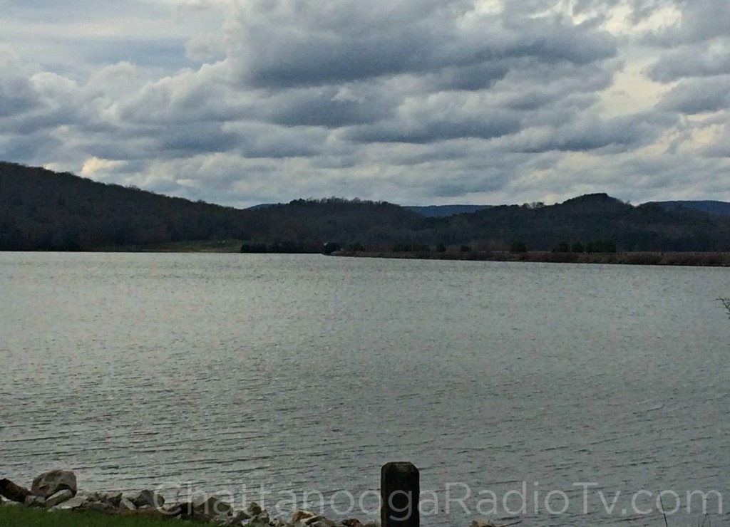
There seems to be little doubt among modern-day experts that the marker is about a mile off the 35th parallel, which according to legal statute, is the actual line. It should be, they say, right in the middle of Nickajack Lake.
Yes, all that water, just out of Georgia’s reach. But as currently drawn, it is a 200-year-old line, and unlikely to budge any time soon.
So in 2013, Georgia lawmakers claimed the true boundary line would enable Georgians to lay claim to Tennessee’s abundant water supply. Despite the outcry, and some well-researched evidence that seems to prove them right, the state line hasn’t moved. Apparently, the courts are reluctant to start moving state lines that have existed for two hundred years. As surveyor Crattie told NPR, “Lord, if you started changing property lines, it would just be chaos.”
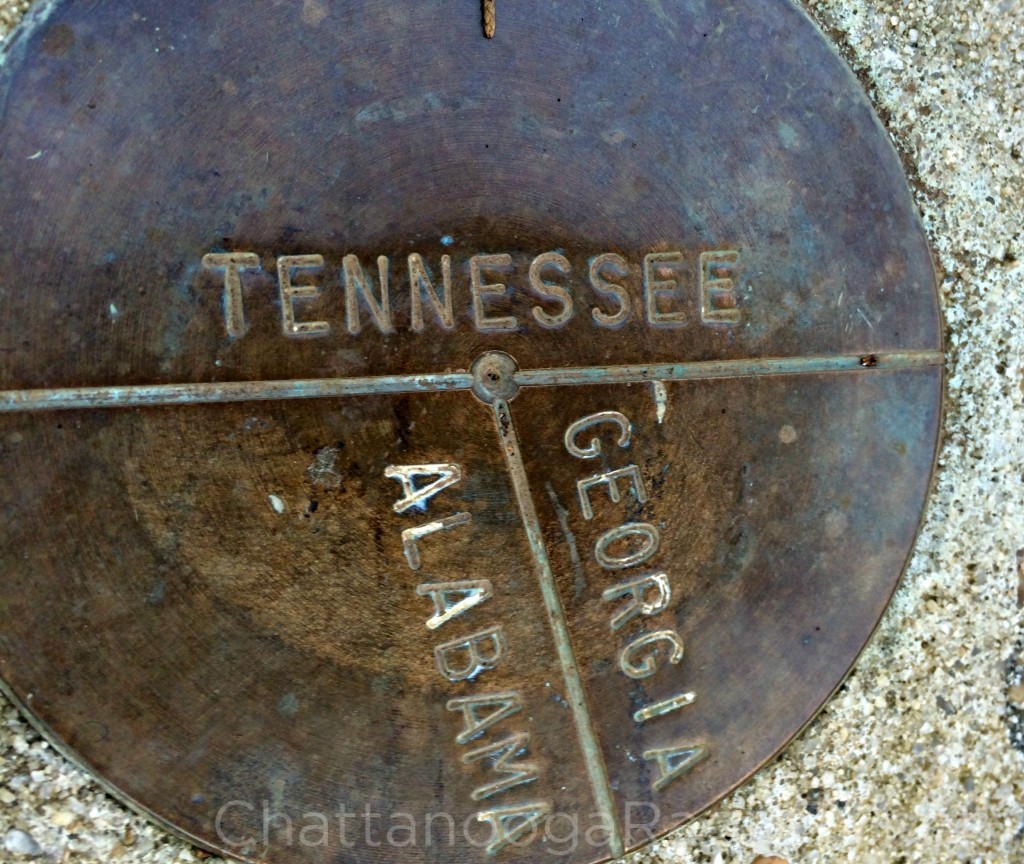
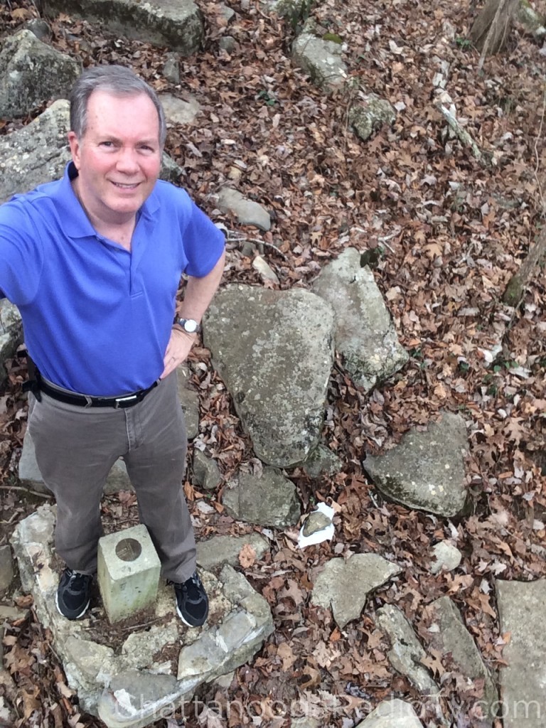
About ten years ago, some interested parties found the spot, and were kind enough to create a small monument, and then drive it into the ground for all to see. The key word is “small,” about four inches in diameter.
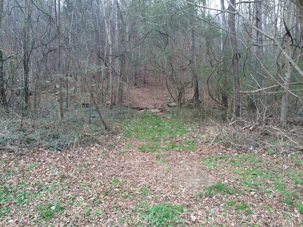
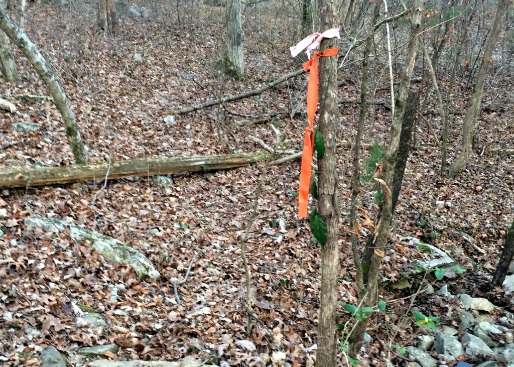
Considerately, they placed bright orange surveyor’s tape on some trees to keep people like me from wandering off the trail. Even with their help, I pretty much stumbled on it, thanks to a white paper towel held in place by a rock. I removed the rock, and there it was!
For the first time in my life, I was truly a tri-state guy. My left foot was in Tennessee, and the big toe of my right foot was in Georgia. The heel of my right foot was in Alabama. It was sort of like being a Volunteer Bama Dawg.
I was standing in one of only 38 such spots in the USA, where three states are so connected on dry land (23 are in the middle of rivers, streams or lakes). I’m told that more than 200,000 tourists a year visit the Four Corners monument, where the states of Utah, Arizona, New Mexico, and Colorado all meet. I doubt more than a handful visit our little triangle, but I’m glad I did.
I was fortunate to go on a dry, comfortable December day. I didn’t have to deal with mud, weeds, poison ivy, snakes or other critters. If you would like to stand in all three states, here are the directions:
From I-24, take exit 161 (Haletown/New Hope). Take TN-156 west (a curvy, winding road) 3.8 miles, then turn left on Macedonia Church Road. Go 7/10 of a mile, then turn right on Huckabee Road (it isn’t marked, but it is just before you see several mailboxes on the left). Go 3/10 of a mile and park just beyond the Stateline Cemetery. You’ll see the beginning of a trail straight ahead. Walk about 50-75 yards (estimated) and you’ll see orange surveyors tape on some trees. The marker stands about a foot off the ground, and lies just ahead of a natural stone formation.




Love this as I have ties to all 3……but Al will always be my home although I have been in Tn for 50 plus yrs!!!!! RTR
The last time I was there, “the rock” was covered in poision ivy!
So very cool . We live in Delaware and are considering visiting smokey mountains and came upon this information about being in three states at once ! We are intrigued and may try it
Yall should visit it, I live in TN and have never seen this but I live close so I will be planning a trip myself long story short it is so different down here from Delaware in my opinion!
I have lived here all my life and was unaware of this spot. What a great story line.
Glad to see you found it. I was the person you asked directions, while picking up our buckets we lost in the road. We knew you were lost being back in those parts. We were on our way out to the lake to get water for the horses. Nice story. There is a lot more history down in that holler. It is the old Cole City.
Thanks Jenny, I’d probably still be going around in circles if you hadn’t pointed me in the right direction!
great info!
My husband has family buried in the State Line Cemetery, which is just off the back side of Sand Mountain, GA where we live, we go there every year to place flowers on the graves. Next time we go we’ll make the hike into the woods to check out the marker. Thanks, David!
Interesting story nephew. You are good at writing them. I can’t help but wonder when that marker was placed there? How many years it’s been there? Like you, I was born and raised near there at Bryant, known as Long Island, Alabama in the 40’s, 50’s and 60’s.
Mr. Carroll,
You mentioned Long Island in your post. I have traced my great grandmothers family history (Jacoups) to a place called Yucca. I believe it to be near Long Island, her brother in law Zoom Long was a postmaster in Long Island. I would love to visit Yucca for pictures but can’t seem to find out how to get there. Do you know how to get to Yucca?
Yucca is what is now called Racoon Creek near Stevenson. Taking AL Hwy. 117 toward sand mountain, just before you start up the mountain turn right onto county road 91. This road will dead end to a dirt road that winds along the base of the mountain where there are some cabins and a boat ramp. Part of it is referred to as twin lakes and then at the dead end it is called Raccoon Creek…or coon creek. If you have other questions you can contact me by email vellak2011@gmail.com. Here is a map for you. http://www.placekeeper.com/Alabama/Map/Yucca-1959075.html
I grew up in Western Penna. SW of Pittsburgh where Ohio Penna and Wva are close together. It’s referred to as The Tri State Area. We have a business place in Wva. but my home is 8 miles away in Penna,,,if we cross the river we’re in Steubenville, Ohio where they had a HS Rape situation similar to Ooltewah’s You probably had it on your news couple years ago. Nice Article. Thanks
I have been here. but today would be a great day to go down and take pictures. I have never taken pictures of it. Thanks David.
I read your 12/28/’15 article re: the tri point AL-TN- GA, very interesting. Even more interesting is the NW border of AL where it juts up 0.86+ miles into TN. By virtue of this Upjut, TN is South of AL and conversely Al is North of TN. I have always been interested in the vagaries of borders worldwide but especially in the US. Tennessee has probably the greatest number of controversies of its borders. Pull up the USGS Lookup website, it offers greater accuracy than Google, enlarge that portion and enjoy the view. http://viewer.nationalmap.gov/viewer/
What’s the actual address to go here anybody know ? Would love to go see this,
Hi Bryan, the directions are at the end of the article. I hope you enjoy it!
Hi David, Kenny Hill and I (cindy) own Grant Summit Cabins in Bryant AL, I am making a information book for our guest. Kenny and I where just talking about how to get to the tri-state-line. Great article. Thanks for the directions.
Want directions to the three states, al, tn, and ga
Directions
Thanks. The directions were perfect.
We followed your EXCELLENT directions and found the monument with no problems at all! We are not from TN, so the mountain roads and roads without signs that “everyone knows” can be very confusing. We love these interesting surveying monuments, and of course it is always fun to be together, but in different states. Thank you for this lovely post – we never would have known about this special spot otherwise.
Hey must see,will post when visit
Thanks for the story and the directions we’re spot on. So worth the short drive from Pikeville TN.
My wife and I just came today and, though there is a lot of poison ivy along the sides of the trail, on this sunny summer day there was no mud or overgrowth of the path and it was an easy walk into a pretty section of the woods. Thank you for sharing directions to this really interesting site!
I’m going to be visiting from a place in Canada where there is no poison ivy or snakes, etc. Should I have any concern about walking this trail. I’ll be there in December.
Hi Vince, I have been there the past 2 Decembers, and saw no evidence of any problems. Of course, I can’t guarantee, but it’s a relatively brief hike. I have not been there in mid-summer, but in December there’s not a lot of growth or greenery.
Bring our snow shoes
hello, i’d like to go out and see, if you can please send the address. please & thank you
There is no street address, but the directions in the story are easy to follow. If you need more info, contact me at dcarroll@wrcbtv.com Thanks for reading!
Hi we are staying at Grant Summit Cabins in Alabama…going to see this today!!!! Following some of my history I had never known…Thank you so much
I hope you enjoyed it!
Thanks for the info and perfect driving directions! We drove from Cincinnati, OH today to do the 127 Yard Sale and took a detour to this spot. Very cool!
Thanks for letting me know, I’m glad you found it!
I remember maybe 40 years or so ago, going to a restaurant that had 3 states that met in the middle of it. I believe it was in Tn. Can you help me out on this? Thank you.
THRE IS A PLACE IN ALABAMA/FLORIDA LIKE THAT.
Just visited the marker on Friday afternoon. The trail is well maintained, and there now is a handsome metal arch over the marker as well. Thanks for your directions, which were very helpful.
We just attempted to find this and had no luck at all…???? we walked up and down several trails and the only one that had a marker just lead us deeper into the woods…three very dis-appointed New Yorkers!
These directions were perfect! Loved reading about your experience, which gave us the idea to go. We are from Phoenix, Arizona on Fall Break and were looking for a unique experience in the area. Appreciate the post above from May 2019 noting the metal arch. We saw that first (after following the orange tape). We really enjoyed finding it. Thank you for such detailed directions, and for the idea!
I Would Be Nice To Get A Group Of Volunteers Together And Really Make A Nice Trail! With Ali The Rocks And Old Railroad Ties! And Up Grade Around The Marker! Flatten Out With Flat Stones And Quick Crete About 6 Feet Around! And Maybe A Bench! And A History Plaque! Maybe Plant Some Native Plants Around It!
I went to the tri state marker in NW Louisiana where TX and AR meet with LA. LA and TX clearly marked by Welcome signs but Arkansas is scrub brush in that area. Someone coming out of the liquor store said it was behind the store. It was raining and I was on a motorcycle otherwise I would have looked for a road into Arkansas. Map shows a dirt road going in, otherwise just I-49 30 miles east.
Is there any GPS coordinates for the marker?
Great directions! Found it perfectly. They have added a metal sign at the end of the road after the cemetery. And thankfully yes at the fork in the road there were two orange ties and when we looked left we saw the new metal arch over the point. Unfortunately somehow or someone removed the marker but because of the video above we saw that we were in the correct spot. Thank you. This was a great treat for my family.
My wife and I are in Chattanooga for the week and decided to go find this marker yesterday. Thanks for the video and directions. Big help! As Teresa stated above, there is now a metal arch over the point and unfortunately it looks like someone vandalized the marker because it is gone, busted clean off. Have to imagine something like that was done on purpose. Sad that some people have to ruin things that don’t belong to them.
Same experience as Ken above. Live close and had never been there. Closer to the lake than I realized. Not surprisingly it had been vandalized. What a shame. Still worth the trip.
I just searched Google maps for it and it brought it up. Can’t wait to take my husband to check this out. He loves stuff likes this. I took him to Rock City for the first time 2 weeks ago. Thanks for the article David.
Hi David
I own Paradise Pointe which overlooks Tennessee River/Nickajack lake. I own the land on the Alabama side to the Tri state corner. I have a hiking when you enter Alabama that leads to the Tri state corner. Turn on 377 & start up the mountain, road changes to 73 when you enter Alabama. Paradise Pointe is as soon as you enter Alabama. We have 19 vacation rentals at Paradise Pointe and a huge Indoor Pool House. We also have a website paradisepointe.holidayfuture.com
Some people that reads your book might want to stay at Paradise Pointe and visit the tri state corner from our hiking trail.
Brent Hill
Here now– lovely place and we are planning on doing the trail!
I would love to visit there the next time I visit family in Georgia. I have stood on the KY, TN, VA market at the Pinnacle in Middlesboro, KY